
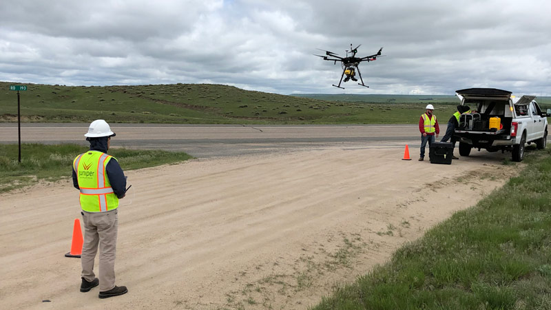
Data Collection
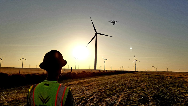
Juniper Unmanned will select the best technologies and design the mission parameters, including how the data will be processed, managed, and analyzed. We have a wide range of options including LiDAR, Multispectral Imaging, Bathymetric LiDAR, Thermographic Imaging, Photogrammetry, Magnetometery, and many others. We operate from satellites, manned aircraft, drones, vehicles, and from the ground. The broad range of options allows us to provide you with the best one for your needs.
Analytics & Insights
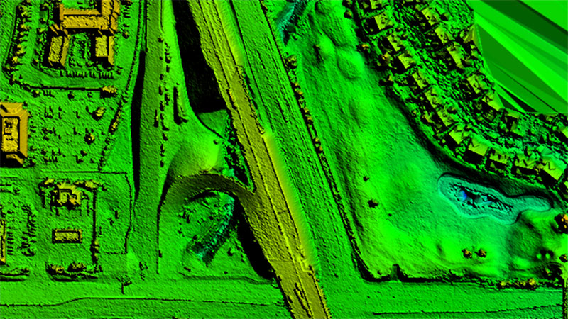
The value of a data set is generated through analysis. Juniper Unmanned’s expert team of data analysts helps clients find the answers in the data. A single data set can inform designers, support the logistical planning of the construction, audit quantities, and be used for determining changes in condition. Combining powerful off-the-shelf remote sensing software with innovative AI/ML technologies we deliver derived products which allow meaningful insight and actionable intelligence.
Outsourcing
Juniper provides enterprises with ready-made white labeled UAS programs. You can have all the benefits of a full-scale drone operation, without the challenges, risks, and expenses of setting one up on your own. We will take care of the hardware, software, personnel, and training systems. You can have the entire program established in weeks, complete with an experienced team with deep knowledge of how to get things done safely, effectively, and in compliance with regulations.
Markets

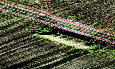
Transportation
Right of way mapping, geohazard remediation, engineering design surveys, slope stability surveys, post-construction as built data, able to support State DOT Standards (i.e. TMOSS).

Land Development (AEC)
Rapid, as needed deployment to enable your field personnel to quickly assess your site conditions and streamline the planning and staging process. Access remote and rugged terrain and reduce exposure to hazardous field conditions.

Utilities
Preliminary design surveys, planimetric maps, contour maps, calibrated point clouds, bulk-material quantities and project takeoffs. Solutions include XML, DTM, TIN data, cross sections, point files, contours and can be delivered in most CAD/GIS formats.

Petroleum & Pipeline
Moving oil and natural gas safely through hundreds of miles of pipeline infrastructure requires accurate and well-maintained maps. From well pads to pumping stations to pipelines to storage facilities, critical assets must be precisely located, and their day-to-day operational conditions must be carefully monitored.

Natural Resources
Any natural resource professional will tell you that accurate, up-to-date maps are indispensable for their day-to-day work. But mapping in remote, hard to access areas, with challenges of terrain and vegetation make traditional surveying methodologies impractical and expensive.

Featured Success Story
Surveying Roadways at Scale
Featured Success Story
Detecting Abandoned Wellheads
Featured Success Story
Monitoring Uranium Storage Facilities
Latest News
Juniper Unmanned Finishes Over 350 Miles of Road Survey – With a Drone
August 8, 2020
DENVER, COLORADO Juniper Unmanned, Inc., a Colorado-based remote sensing and analytics integrator announced its completion of pre-construction survey of highways for the Colorado Department of Transportation. It’s the first time drone technology has been successfully utilized to provide a state department of transportation with survey data that meets the survey… read more >