Schedule a free consultation Let’s Go
Success Story
Wildfire Debris Flow Modeling
The Mission
Design the methods for collecting drone-based data in rugged mountainous terrain and building models to predictively analyze debris flow."Our team has worked tirelessly to get Glenwood Canyon on I-70 opened as soon as possible and we have made each minute count." - Governor Jared Polis
Mission Objectives
The Grizzly Creek Wildfire caused substantial damage to the forest, destabilizing the soil and leading to massive amounts of erosion. The Colorado Department of Transportation and managers of the Colorado River Watershed were concerned about infrastructure that would likely be impacted by future erosion events. Debris flows were predicted to damage structures, and the interstate highway. The debris and mud would likely pollute the Colorado River, resulting in water quality issues for years. Juniper Unmanned was asked to build highly accurate 3-dimensional models of the terrain and to monitor the changes in the terrain over time. This data we collected will be used to help structural and environmental engineers design appropriate mitigation efforts. The data would need to be acquired in rugged mountainous terrain.
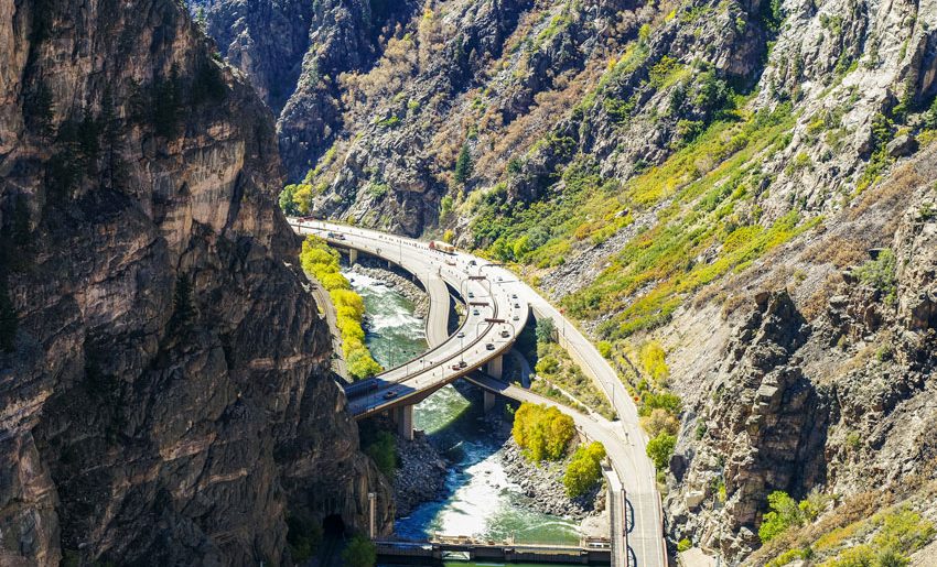
A drone view of Glenwood Canyon with I-70 and the Colorado River below. Debris from a wildfire threatened to damage the road and pollute the river.
The Solution
Juniper Unmanned built flight-planning procedures for conducting drone-based LiDAR operations at high altitude in rugged terrain. We integrated the sensor on a heavy-lift drone, accounting for the modified vibration frequency. Because of the complexity of the procedures, the client preferred for Juniper Unmanned to conduct these operations for them on future operations rather than for us to train and support their existing drone program.